



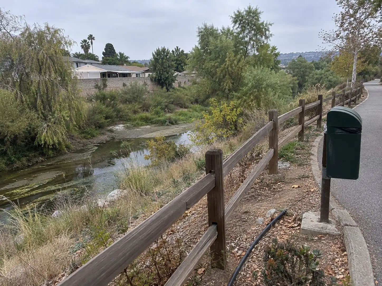
If you are looking at a home along the San Diego River corridor in Santee, the flood map is one of the first documents worth reading, and it was redrawn recently. The City of San Diego’s flood map update summary lists new FEMA flood maps effective March 3, 2026 for Santee, San Diego, Poway and El Cajon. A home that was outside a flood zone last year may now be inside one, and the reverse is also possible.
This article explains what the zones are, what a change does to a loan, and how a buyer or seller should handle it. It describes rules and property facts, not neighborhoods.
What is a Special Flood Hazard Area?
A Special Flood Hazard Area is the land FEMA maps as flooded by the base flood, the flood level often called the 100 year flood. Those areas carry the Zone A and Zone V family of labels on a Flood Insurance Rate Map. In Santee the mapped areas follow the river corridor and its tributaries, and the City of Santee’s flood zone page says the city has a San Diego River Floodplain Study that defines special flood hazard areas.
The map is a model of ground elevation and water flow, not a record of what has happened to a particular house. A home can sit in the mapped area and never have taken on water, and a home just outside the line is not guaranteed to stay dry. Treat the map as the tool lenders and insurers use, and treat the property’s own history and elevation as separate facts.
What changed on March 3, 2026?
FEMA revised the maps using new engineering studies. According to the summary published by the City of San Diego, the studied areas were the San Diego River from El Capitan Reservoir to the Mission Valley YMCA, plus Sycamore Creek in Santee. The summary says the updated maps may add areas to flood hazard zones, remove areas, and change flood elevations and boundaries, and that these changes can affect insurance, planning and building requirements.
The Santee flood zone page itself does not describe the new maps. It points to FEMA’s Flood Map Service Center at msc.fema.gov for looking up a zone and pulling the map panel. Search the address there, note the current effective map and the zone shown, and keep a copy in your file. Do not rely on an old printout or on a listing description written before the update.
What happens when a home moves into or out of a zone?
A home that moves into a Special Flood Hazard Area can trigger a flood insurance requirement, and a home that moves out can lose one. The federal rule applies to loans made by federally regulated lenders or backed by a federal program, and the lender orders a flood determination during the loan process. Conventional, FHA and VA loans generally fall on the federally backed side, which is why a zone change can show up as a lender condition late in escrow.
For a buyer, the question to put to your lender and your insurance broker early is whether the property needs flood coverage on your loan, and what it takes to get a quote. For a seller, a map change since your own purchase may mean a buyer is facing a requirement you never had to think about. Neither of you should guess. This article does not quote coverage costs because they depend on the property, the zone and the carrier.
What are a LOMA, a LOMR and an elevation certificate?
These are the three tools that come up when a mapped home does not match its real elevation. A Letter of Map Amendment is FEMA’s determination that a specific property or structure sits above the base flood elevation even though the map shows it inside the flood zone. A Letter of Map Revision changes the flood map itself, typically because of new engineering or physical changes to the land. Both fall under the umbrella of Letters of Map Change, and the City of San Diego’s summary says a request has to be supported by evidence such as ground elevation data or updated flood studies.
An elevation certificate is a form completed by a licensed surveyor or engineer that records a building’s elevations against the base flood elevation. It is the usual evidence behind a LOMA request, and insurers and lenders often ask for one. If the map has just moved on a home you are buying or selling, ask whether a certificate already exists. If it does not, a survey is the step that turns an argument about the map into a measured fact, and the process on FEMA’s side takes time, so it is better started before the contract has a tight deadline.
What does Santee’s floodplain code require for building?
Santee has a Flood Damage Prevention Ordinance, linked from the city’s flood zone page, and the page states that new construction should be elevated to a minimum of one foot above the 100 year floodplain provided in the city’s flood study. That is the one foot above base flood elevation idea, often called freeboard. The ordinance text itself was not checked for this article, so read the code section directly before you rely on it for a remodel, an addition or a rebuild.
This matters most to owners planning substantial work. A repair after a loss, a large addition or a teardown near the river can trigger floodplain review, and the city’s Planning and Building staff can say what applies to a given parcel. Ask before you price a project, and get the answer in writing. Unpermitted work in a floodplain is its own problem, covered in our guide to unpermitted work disclosure.
How does the Natural Hazard Disclosure treat flood zones?
California sellers of most residential property must disclose whether the home is in a FEMA Special Flood Hazard Area, and the statement lists that finding under Civil Code section 1103.2. A Natural Hazard Disclosure provider checks the parcel against the current FEMA map and marks the flood line yes or no. Our guide to NHD reports walks through each box on the form.
Timing is the practical issue after a map update. The report reflects the map in force when it is prepared, so a seller working from a report ordered before March 3, 2026 should order a fresh one rather than reuse an old one. The wider set of seller obligations is in our seller disclosure guide. A disclosure box is not a defect finding, and a yes on it is not a reason to panic. It tells the buyer which map applies.
Is a dam inundation area the same thing?
No. A dam inundation area is a different map, prepared under state dam safety law, that shows what would flood if a dam failed. It has its own line on the Natural Hazard Disclosure and does not trigger the federal flood insurance requirement by itself. A home can be on one map, both or neither. We explain that in full in the Prado Dam article, and the same logic applies to any river corridor, including Santee’s.
A checklist before you offer or list
Start with the parcel. Look up the address on FEMA’s Flood Map Service Center and note the zone and the effective date of the panel. Ask your lender whether flood insurance is a loan condition, and ask an insurance broker for a quote before you remove contingencies. Ask the seller or your listing agent whether an elevation certificate, a LOMA or a LOMR exists for the property.
Inspect for what the map cannot show. A home inspector can look at drainage, grading, crawlspace moisture and past water stains, and a pre-listing inspection lets a seller find those items first. Zarko Maletin is a Realtor and InterNACHI certified home inspector, and that combination is exactly the point: the map answers a lending question, and the inspection answers a condition question.
The short version
New FEMA flood maps took effect for Santee on March 3, 2026, and they may have moved a home near the San Diego River or Sycamore Creek into or out of a Special Flood Hazard Area. Check the parcel on FEMA’s Flood Map Service Center, ask the lender and an insurance broker what the zone requires, and use an elevation certificate, a LOMA or a LOMR where the map does not match the ground. Sellers should order a current Natural Hazard Disclosure, and anyone planning building work should confirm the city’s floodplain rules first.
If you want a Santee home priced with the map in mind, start with the home value tool.
Common questions
Did FEMA update the flood maps for Santee?
Yes. The City of San Diego's flood map update summary lists new FEMA flood maps effective March 3, 2026 for the cities of San Diego, Santee, Poway and El Cajon. The studied areas include the San Diego River from El Capitan Reservoir to the Mission Valley YMCA and Sycamore Creek in Santee. Check your own parcel on FEMA's Flood Map Service Center, because the update can add areas, remove areas or change flood elevations.
If my Santee home is in a flood zone, do I have to buy flood insurance?
Not automatically. The federal requirement applies when the home sits in a FEMA Special Flood Hazard Area and the loan comes from a federally regulated lender or is federally backed. A cash buyer or a home outside the mapped area is not caught by that rule, though a lender can still ask for coverage for its own reasons.
What is the difference between a LOMA and a LOMR?
Both are Letters of Map Change issued by FEMA. A Letter of Map Amendment says a specific property or structure sits above the base flood elevation and was mapped in by mistake. A Letter of Map Revision changes the map itself, usually after new engineering or physical changes. Both rest on evidence, and an elevation certificate is often part of it.
Is a Santee home near the river in a dam inundation area?
That is a separate question from the FEMA flood zone. Dam inundation maps show what would flood if a dam failed, and they appear on their own line of the Natural Hazard Disclosure. Our Corona Prado Dam article explains the difference in detail.
