



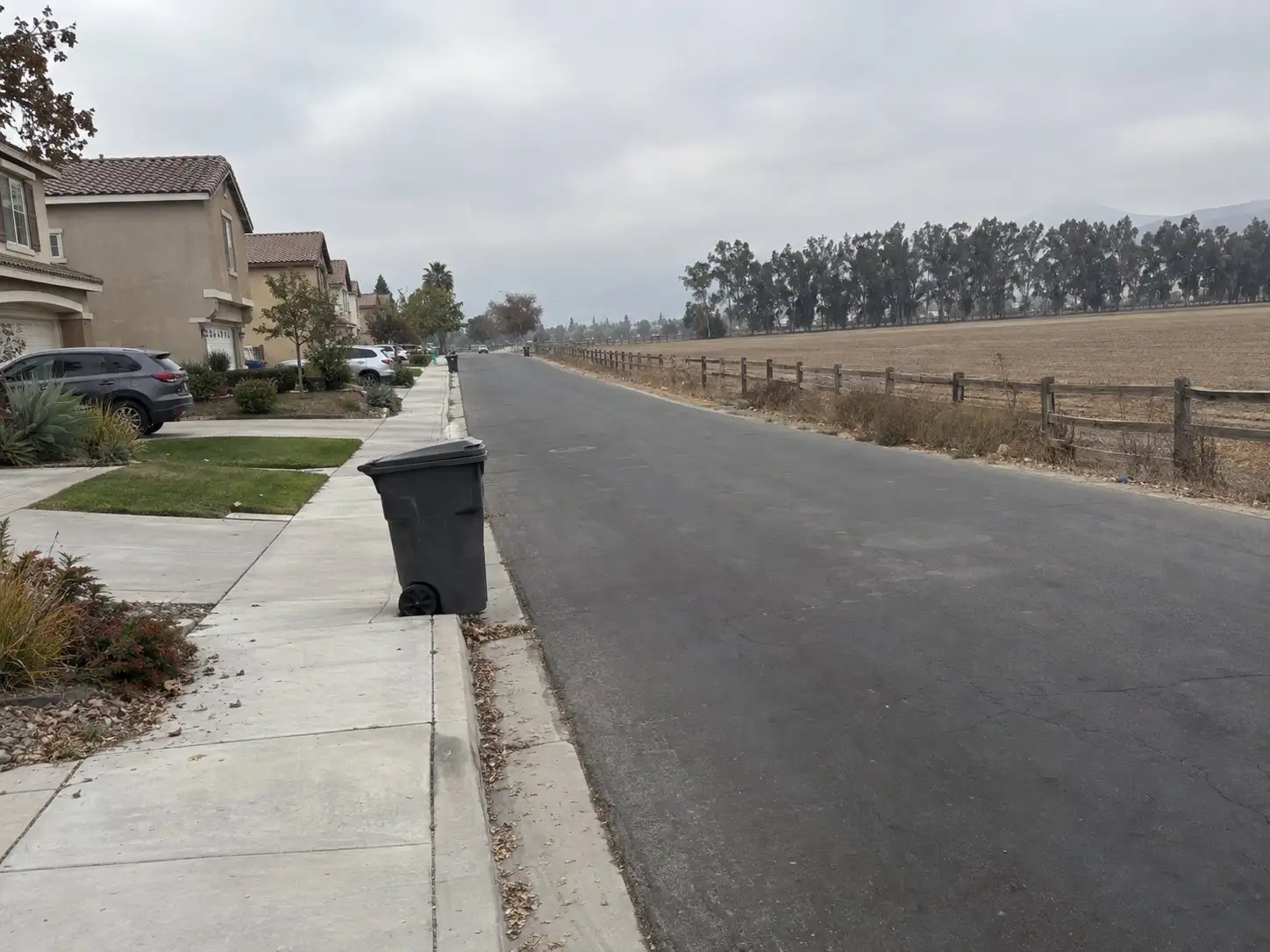
Eastvale is one of the youngest cities in Riverside County, and the ground most of it sits on was dairy country until very recently. That combination shapes a handful of practical questions a buyer here should ask that don’t come up the same way in an older, more established city.
How new is Eastvale, really
Eastvale incorporated on October 1, 2010, becoming the 28th city in Riverside County, according to the Riverside County Local Agency Formation Commission’s municipal service review of the city. Before that date, the area was unincorporated land within Western Riverside County, and the push toward cityhood only started in the spring of 2007, when five residents formed the Eastvale Incorporation Committee, per the city’s own history page. That means the city government, its zoning code, and most of its public infrastructure are all younger than a lot of the buyers now shopping here.
Dairy country, not that long ago
The city’s history page is direct about what was here first. It describes at least 176 years of farming and dairy use on the land, starting with Mexican land grants in the 1830s and continuing as Los Angeles-area dairy families, largely Dutch and Portuguese, moved their herds into the valley through the 1950s. The city’s own “About Eastvale” page still describes the community as having transitioned “from a former dairy enclave to a diverse, well-appointed community.” This isn’t a marketing flourish. It’s the reason the street grid, the parcel shapes, and the pace of development here look the way they do.
Over the decades the dairies gave way to housing, and the city now describes itself as a former dairy enclave. One of the largest remaining dairy properties, land held by the Leal family in the northeast part of the city, became the site of the 160-acre Leal Master Plan that the City Council adopted in 2017, covering the area at 58th Street, Hamner Avenue, Limonite Avenue and Scholar Way.
The dairy parcel that’s becoming downtown Eastvale
That same Leal property is now Eastvale’s planned downtown and civic center. The city’s plan calls for retail and commercial space, a new city hall, library and police station, parks and gathering areas, and additional housing on what was dairy land within the last decade. The developer building it out, New Home Company, has entitlements in place and construction underway on the residential piece, marketed as Eastvale Square.
For a buyer, the relevant part isn’t the ribbon-cutting. It’s that construction activity, traffic patterns, and the tax structure around a brand-new mixed-use district will keep changing near that site for years. If you’re looking at a home anywhere near 58th Street, Hamner Avenue, Limonite Avenue or Scholar Way, ask what phase of that project is currently active and what’s still planned, not just what’s already built.
Special taxes on the newer tracts
This is where Eastvale’s development timeline actually shows up on your tax bill. The city’s Finance Department lists several active Community Facilities Districts, formed under the Mello-Roos Community Facilities Act of 1982, including CFD 2017-1 Goodman Commerce Center, CFD 2017-2 Sendero, CFD 2019-1 Cloverdale Estates, CFD 2020-1 Hamner Place, and the newer CFD 2024-02 zones that specifically cover Eastvale Square and Magnolia Ranch, the same dairy-to-downtown project described above. There’s also a citywide maintenance CFD the council moved to form in 2024. On top of that, the city notes that some parcels fall under districts run separately by Jurupa Community Services District rather than the city itself.
Eastvale’s CFDs are structured as non-bonded, maintenance service districts, which the city describes as financing ongoing services rather than repaying construction bonds. That’s a different animal from a bonded CFD that pays off infrastructure over a set number of years. A non-bonded, services-only special tax doesn’t come with a built-in end date the way a bond-backed one does. It’s a distinction worth understanding for Mello-Roos generally, and specifically worth asking about for any Eastvale parcel, since the answer differs by tract and by which agency administers it. The city’s finance page links to a public parcel-lookup tool through its assessment administrator, and that’s the way to get the number for a specific address rather than guessing from the neighborhood name.
Soils and grading on former agricultural land
Land that was farmed or grazed for decades before it was graded for a subdivision isn’t automatically a problem, but it’s a different starting point than raw undeveloped land. A production builder developing a new tract typically has geotechnical and grading reports on file as part of the permitting process, and those records, along with the graded pad certifications, are part of the public permit history for the property. If you’re buying a home built in the 2000s or later on what used to be dairy or farmland, it’s reasonable to ask your agent to pull the grading and permit history and to have your inspector pay attention to signs of uneven settlement, drainage patterns around the foundation, and how water moves across the yard after rain. None of that implies contamination or a defect. It’s simply due diligence that matches the land’s actual history, and it pairs naturally with the disclosures you’d already review through an NHD report.
The Santa Ana River and flood zones
The Santa Ana River runs along Eastvale’s entire southern edge, forming the boundary with the City of Norco, per the same LAFCO municipal service review cited above. FEMA maintains the official flood hazard maps for that area through its Flood Map Service Center, and flood zone status is determined parcel by parcel, not by city or neighborhood in general. A home a few blocks from the river can carry a different designation than one closer to it, depending on elevation and where the mapped floodplain lines fall. If a home you’re considering is anywhere near the river, particularly along the city’s southern edge, look up that specific address at FEMA’s Map Service Center before you assume anything either way. Your NHD report will also flag it if the parcel sits in a mapped Special Flood Hazard Area, which is one more reason to actually read that document rather than skim it.
What this means if you’re comparing homes
None of this is a reason to avoid Eastvale. It’s context for the specific questions worth asking on a specific house. A 2005 tract home a mile from the river and a 2024 townhome inside the Eastvale Square district face different versions of the same underlying facts, new city, recent agricultural land, and active development, so the special tax line, the grading history, and the flood zone lookup are going to come back with different answers for each. If you’re weighing a brand-new home in one of the active CFD zones against a resale a few years older, the tradeoffs are similar to what any buyer faces choosing between a builder closeout and a resale home, plus the added step of checking which special district, if any, comes with the parcel.
The short version
Eastvale is a city built mostly in the last twenty years on land that was dairy and farm country for more than a century before that. That shows up in three concrete places on any given purchase: whether the parcel sits in an active Community Facilities District and what kind, what the grading and permit history says about land that used to be farmed, and where the parcel falls on FEMA’s flood maps relative to the Santa Ana River. None of these are reasons to walk away from a house. They’re reasons to ask before you’re in escrow.
If you’re pricing a home in Eastvale and want the special tax situation, the permit history and the flood zone question answered together before you make an offer, start with the home value tool. It is a starting point before a conversation about your specific home.
Common questions
How old is the city of Eastvale?
Eastvale incorporated on October 1, 2010, becoming the 28th city in Riverside County. Before that it was unincorporated land, farmed and used for dairies for well over a century, according to Riverside County LAFCO's municipal service review and the city's own history page.
Is Eastvale still a dairy town?
Not in the way it was. The city describes itself as a former dairy enclave, and the Leal family's dairy land, one of the largest remaining dairy properties, is the site the city approved for its downtown and civic center.
Does every Eastvale home have Mello-Roos?
Not every home, but check every home. The City of Eastvale lists multiple active Community Facilities Districts covering different tracts, and Jurupa Community Services District administers others. There is no citywide rate, so you look up the specific parcel rather than assume based on the neighborhood.
Is Eastvale at risk of flooding from the Santa Ana River?
Some of it, and it depends on the parcel. The Santa Ana River forms Eastvale's entire southern border with Norco, and FEMA maintains flood hazard mapping for the area through its Flood Map Service Center. The only way to know a specific address's zone is to look it up there, not to assume from the city's general location.
Do I need a soils report on a newer Eastvale tract home?
A production home builder typically already had one done, and permit and grading records are public. For land that sat under agricultural use for decades before it was graded for a subdivision, asking to see that record, and asking your inspector to flag any settlement or drainage issues, is a reasonable step before you close.
